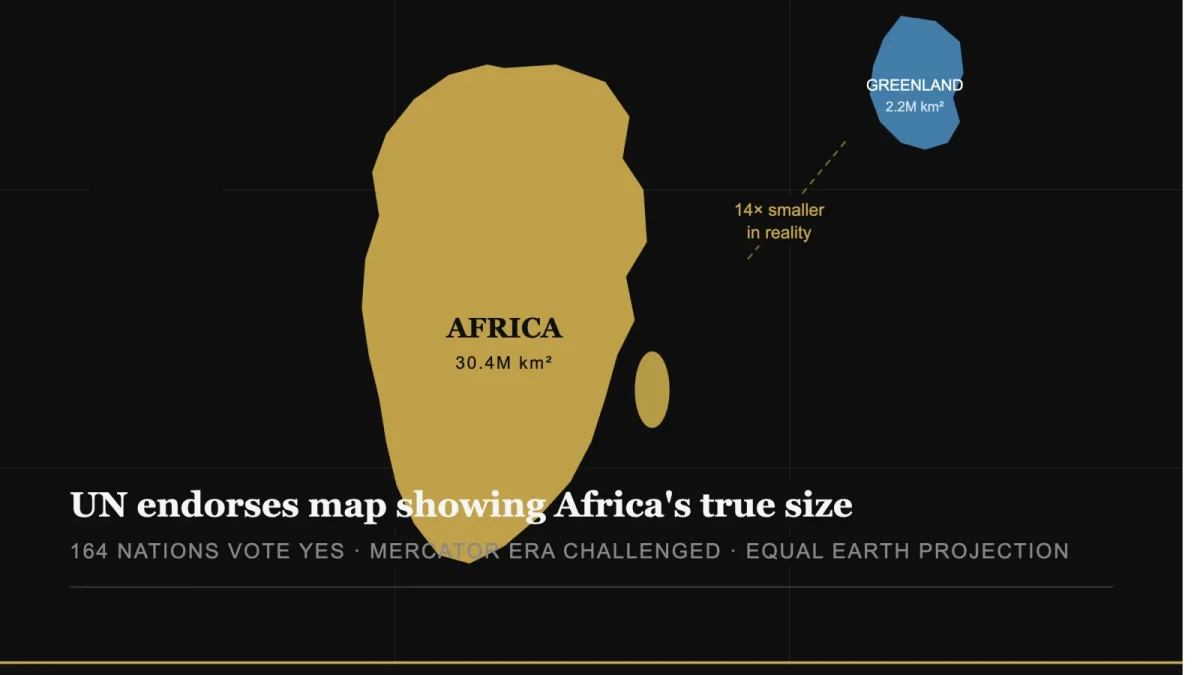
The United Nations General Assembly has endorsed a new world map that more accurately reflects the true size of Africa, marking a major victory for an African-led campaign to correct long-standing distortions in how the world is represented.
The resolution, sponsored by Togo and supported by members of the African Union, was adopted on Friday with 164 countries voting in favour.
The United States was the only country to vote against the resolution, while Serbia, Estonia, Georgia, Lithuania, Moldova and Ukraine abstained.
The resolution encourages governments, educational institutions and organisations worldwide to consider replacing the centuries-old Mercator projection with the Equal Earth projection, which is designed to represent continents in proportions closer to their actual size.
Under the widely used Mercator projection, Greenland can appear comparable in size to Africa. In reality, however, Africa is about 14 times larger than Greenland.
The UN stressed that the resolution does not ban the Mercator map or make the Equal Earth projection compulsory. Instead, it encourages greater use of maps that provide a more geographically accurate representation of the world’s landmasses.
“Maps shape our understanding of the world,” Togo’s Foreign Minister Robert Dussey said ahead of the vote, according to the UN. “They guide education, nourish the imagination, and influence collective perceptions.”
Africa No Filter, one of the organisations behind the campaign, welcomed the resolution and called for more accurate maps to be adopted in schools, textbooks, newsrooms, businesses and digital platforms.
The organisation said it wanted the Equal Earth projection to become more visible in the everyday spaces where people learn and consume information.
French Foreign Minister Jean-Noël Barrot also welcomed the decision, saying on X that changing a map does not change the world, but correcting a distorted representation is “an act of truth.”
Why the Mercator Map Has Been Controversial
The Mercator projection was developed in the 16th century by Flemish cartographer Gerardus Mercator, primarily to assist European navigators at sea.
While the projection remains useful for navigation, it significantly enlarges landmasses closer to the North and South Poles while making regions closer to the equator appear smaller than they actually are.
As a result, Greenland and parts of North America and Europe appear much larger relative to Africa and South America than they are in reality.
The Equal Earth projection, introduced in 2018, was designed to preserve the relative areas of continents more accurately while maintaining a visually balanced representation of the globe.
The UN vote does not force countries to abandon the Mercator projection, but advocates hope it will accelerate a global shift toward maps that better reflect the actual proportions of the world’s continents.
Comments
Be the first to comment.